Thistle

Friday 25 November 2011

Hidden Gems at the Ruskin Picnic Site

For bird watchers in November and December the Ruskin Picnic area is "bird de jour."  On this sunny November afternoon there were more than 50 eagles, double that number of hawks, and at least 20 Herons which were all within a 10 minute walk.
This morning the only company I had besides the birds were the half dozen fishers who were concentrating at their task.  The day-to-day the water flow in this area can change dramatically as BC Hydro alters the flow out of Hayward Lake.  I was able to watch a heron settle a dispute with a hawk only to fly off in pursuit of some unknown shiny thing. If you decide to hike in this area you must be prepared for the strong aroma of decaying salmon.  On some days it is overwhelming. As the water level does flucuate it is important to wear water proof shoes.

To reach this area turn up Wilson Road from the Lougheed Highway near Mission.  When you reach the dam make a right turn over the dam when it is safe to do so.  After about half a kilometer on the right you will see the entrance for the Ruskin Picnic Area.

More photographs can be viewed at: http://bit.ly/s4cTPE

Please note:  This area is scheduled to be closed to the public as BC Hydro makes substantial upgrades to the Ruskin Dam.

Sunday 20 November 2011

Harrison River

If you enjoy watching Eagles this is the place to go.  From early November until late January the Eagles can be watched as they gorge themselves on spawning salmon.
 Along side the Harrison River is one of the under used golf gems in the Fraser Valley; Sandpiper Golf Resort   and Rowenas Inn (a must for bed and breakfasts).  One can casually walk along side the river taking in the views and dodge errant golf balls at the same time.
From Sandpiper Golf Course one can depart on fishing or site seeing excursions.  During the annual Bald Eagle Festival, Eagle watching boat tours can be accessed from near the Kilby Historical site.

Additional photographs can be viewed here:  http://bit.ly/scQ0iz Come back often as photographs are constantly being added.

The Harrison River can be accessed by driving east from Mission BC along the Lougheed Highway.  When you reach the Sasquatch Inn you have arrived.  A mere 200 meters further is the bridge over the Harrison River.

Wednesday 9 November 2011

Ellwood Park - Abbotsford


One of Abbotsford's gems.  This park features natural waterways which are crossed with bridges and wildlife viewing platforms.  The walkway circles the ponds providing views from every imaginable angle.  This is one of the must see in Fall to experience the full Fall colours which this region has to offer.  The walkways are hard surface and wheel chair accesable.

Location of this park is at Old Yale Road & Maclure Road in Abbotsford.


For more pictures visit:http://bit.ly/v3OEaf

Wednesday 2 November 2011

Hidden Gems on Mount Cheam


One of the most spectacular views in the Fraser Valley is from the peak of Mount Cheam.  From its summit one has views of the Fraser River and Valley, the mountains to the north and east and Mount Baker to the south.  To reach the parking lot where the hike begins one does need a 4 wheel drive vehicle. Climb over the logs at the end of the parking lot and head up the remainder of the logging road.  After about 15 minutes the trail leaves the logging road and heads into the meadows.  Within a few minutes one passes a small lake (pond) and the climb begins.  When on the ridge take care not to venture to close to the edge and the rocks are loose and one can easily loose their footing.


 Directions are as follows: 
Follow Highway #1 (Trans-Canada Highway) to Chilliwack, taking Exit #119 South. Follow Vedder Road until a three-way stop just before a bridge over the Vedder River. Zero your odometer here and turn left at the stop sign onto Chilliwack Lake Road. At the 28 km mark and immediately after one of the Vedder River bridge crossings, turn left onto Chilliwack-Foley Forest Service Road. Zero your odometer again here.
Follow the forest service road for 2.0 km, turning left at the T-junction after the bridge over Foley Creek. Travel west for another two kilometers, turning right on to Chipmunk Creek Forest Service Road next to a large gravel pit. Continue to the parking area at the Mount Cheam trailhead, ignoring all of the branch roads and following the most obvious track the entire way.

Additional photographs can be viewed here:  http://bit.ly/rpRjSM

Sunday 9 October 2011

Kanaka Creek Regional Park

Kanaka Creek Regional Park is a linear park that stretches almost 11 kilometers from the Fraser River. For those who wish to explore the park by canoe or kayak park near the boat launch in a section of the park located near where Kanaka Creek and the Fraser’s meet. To reach this park take Highway 7 (Lougheed Hwy) a short distance east of Maple Ridge where the Bypass reconnects with the Lougheed Highway. A green GVRD sign indicates the way to Kanaka Creek Regional Park’s Riverfront entrance. The park gets its name from the Hawaiians who were employed by the Hudson's Bay Company from 1827 until the 1850,s. The park uses many of the dikes along the Fraser River and as a result there are many level areas for easy walks.  Throughout the year, many many migratory birds can be seen visiting the park.


Additional photographs can be viewed at:  http://bit.ly/ogqZ9f 

Friday 30 September 2011

Willband Creek Park


Willbank Creek Park is located at the corner of the Mission Abbotsford Highway (Highway 11) and Bateman Road in the Sumas Flats.  The center point of this park are the ponds and lakes.  Throughout the year one can watch many of the migratory birds as they walk the level 2.6 kilometer path.   Despite the shortage of trees, Fall colours do exist in the many varieties of grasses along the lake edge.  There are two drawbacks to this park.  First is that many parts of the paths are inundated with "landmines (doggy dew)".  Try to keep one eye on the path as you enjoy the scenery.  Second. there is no escaping from the traffic and local construction noise.  Despite this, as this park matures it will surely be a "gem" that Abbotsford can be proud.


Additional photographs can be viewed at http://bit.ly/nWuDMU

Friday 23 September 2011

Westminster Abby - Mission BC


Up on the hill overlooking the valley is the bell tower with which Mission has become associated.  Some of the best views in Mission can be seen from his location.  One can relax while walking along the paths which meander throughout the grounds of the Abby.  The bell tower was completed in 1957 with the remainder of the Abby being completed in 1982.  More information can be fond here:  http://www.westminsterabbey.ca/   Whenever out of town friends drop in for a visit this is one of the "must see" places where I take them. 

More pictures can be viewed here:  http://bit.ly/q6a26t

Tuesday 30 August 2011

Hidden Gems at Cheam Lake

You can find this hidden "gem" by driving the #1 Highway towards Hope.  The Park is located on the north side of the Freewya around 15 kilometers east of Chilliwack near Minter Gardens.  Take the exit which leads you to Highway #9.  In the Round-about turn east onto Yale Road and proceed to Elgey Road.  At this point follow the signs.  More information can be found here:  http://bit.ly/qTEv9N

This nature reserve has an abundance of wildlife.  From the Rabbit to an unlimited number and varieties of birds.  These include the Blue Heron and in Fall every duck and Goose imaginable.  There is an easy walking trail which provide numerous views of the Lake.


More pictures can be viewed here:  http://bit.ly/pt0sLC


Friday 19 August 2011

Hidden Gems on the Hayward Lake Trails, Mission


Hayward Lake offers scenic hikes which meander around the lake. There are two trails; the Railway Trail on the west side and the Reservoir Trail on the east side. It is possible to do both trails as part of a loop.  Even on the hottest summer days the Reservoir Trail provides relief.  Highlights on the Reservoir Trail include Steelehead Falls and the many bridges which cross the many small streams.  Besides the numerous short glimpses of the Lake the other highlights include the floating bridge and the moss covered trees.  This is truly a rain forest.  Highlights of the Railway Trail include the beaver pond and the long abandoned railway trestles which still stand up from the lake.  The main parking lot, which is the start point for the Railway Trail, has fully operational washrooms and a beach.  Keep in mind that the water is always cold.  More information can be found here:  http://bit.ly/bthump


Additional photographs taken from around Hayward Lake can be viewed at:  http://bit.ly/qpOzSt

Saturday 6 August 2011

Hidden Gems at Nicomen Slough

Located along the Lougheed Highway just east of Mission this waterway becomes the stop over for many of the migrating birds as they head both north and south.  During October through November this one of the premiere spots to view Bald Eagles as they look over the slough from the tree tops.


As this is a stop over for migrating birds this is also the place to go to view Canadian Geese, White Swans, and every species of Ducks that there are.  In addition to the birds the scenery is unbeatable.  On the one side of the Highway is the meandering slough and on the other are mile after mile of dairy farms.  As one drives further out into the Valley the foothills become part of the scenery.


More pictures can be viewed at http://bit.ly/oZBKAf

Friday 5 August 2011

Hidden Gem - Bridal Veil Falls

This hidden gem is located on the #1 Highway between Chilliwack and Hope.  More information can be found here:  http://www.env.gov.bc.ca/bcparks/explore/parkpgs/bridalveil_falls/

The waterfalls are an easy 15 minute walk from the parking lot.  This is a great activity for those hot summer days as the sun rarely breaks through the canopy of the trees.  As you walk along the path you will realize that we really do live in the west coast rain forest as evidenced with all the moss hanging from the tree limbs.  Along the short walk are a number of small bridges which are crossed giving views of the small creeks underneath.
Additional photographs can be viewed at:  http://bit.ly/qzf0eV

Monday 1 August 2011

Hidden Gems at Silverdale Creek Wetlands

Just west of Mission along the Lougheed Highway are the Silverdale Creek Wetlands.  This was a partnership project including the District of Mission which created these wetlands and walkways.  If one can tolerate the mosquito's (which must be expected when in this environment) one encounters almost unlimited wildlife.  It is not unusual to encounter a number of blue herons as one wanders along the trails.  In Spring one must keep a wary eye for Black Bear.  In early fall the water channels are overtaken with spawning salmon and migrating ducks.  Except for in Spring when the Fraser River is at flood stage the paths are usable at all times.
More pictures can be viewed at http://bit.ly/onuNJH and more will be added in the future.

Thursday 21 July 2011

Hidden Gems at Seton Portage

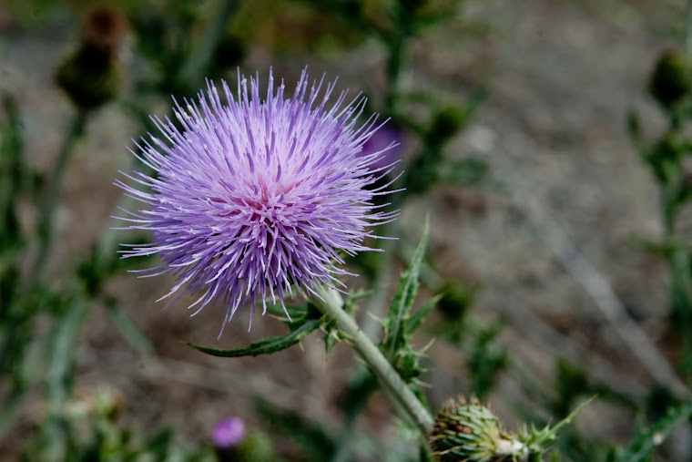
After a long drive up the Fraser Canyon past Lytton to Lillooet and beyond this was one of the rewards.  The last hour and a half were on narrow switch backed gravel roads with inclines not for the faint of heart.  Along the way there were numerous stops for photographing wild flowers and wildlife.  Never having been in these parts before stumbling upon hydro electric projects was a complete surprise.  This church was one of my must see objectives for 2011 as it is doubtful that the church steeple will survive for many more years.  Do not assume that you can find this on your own.  Swallow your pride and stop at Lillooet Tourist Information for directions.  As well they can point you in other places to find some of those "cant miss" and"must see" attractions.  One of these in Lillooet is the old bridge which crossing the Fraser River.  When we were there we were fortunate to witness a hawk nesting on the girders of the bridge.  In Lytton be sure to visit some of the historic churches.  For more photographs visit:  http://www.motioninsports.com/HiddenGemsBC/Lillooett-Seton-Portage/18156664_SCwjbC#1394338337_rThJBvL

Wednesday 20 July 2011

Hidden gems along the west side of Harrison Lake

The adventure begins at the Sasquatch Inn (now what adventure doesn't) or if you are a golfer, at the Sandpiper Golf Resort.  For a few miles the road is paved but then changes to gravel which it remains forever.  It is not recommended that you take your moms Sunday going to church car for this adventure.  I was fortunate to have access to dirt bikes .  At approximately the 20 km point we parked our truck and took off on our bikes.  The photographic opportunities were everywhere.  From views down onto the lake to hidden waterfalls at almost every corner the scenery was breath taking.  All along the road are mossy covered rock outcroppings which, if you take your time, provide many opportunities fro some great photographs.  In addition, do not forget your eyes open for wildlife.  During our short time in this area were were able to see, in addition to birds, 2 different types of deer and a bear.  This is an area I will be making many return trips to so I can expand my photograph collection.